
Introduction
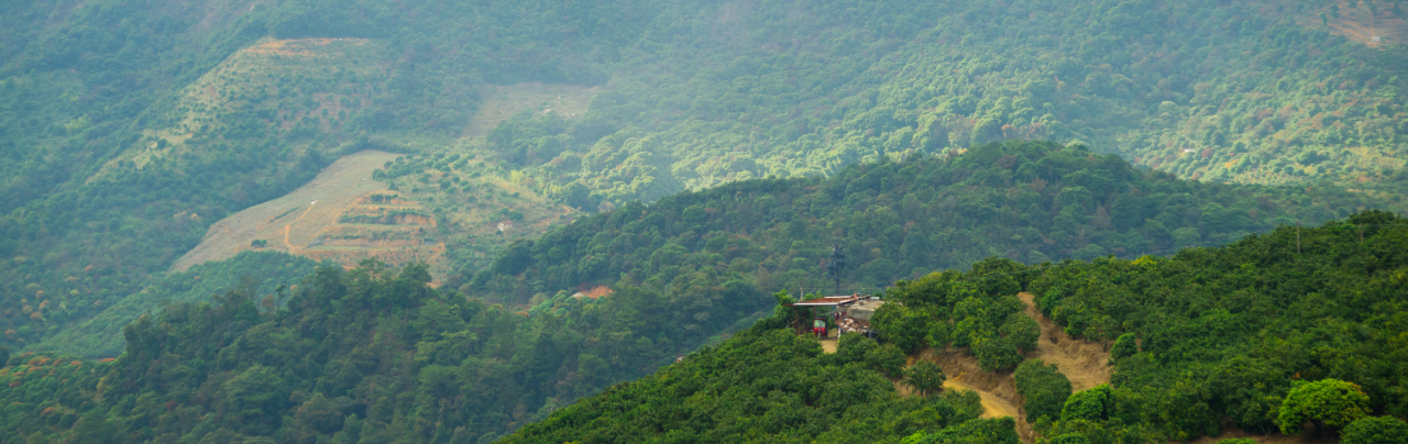
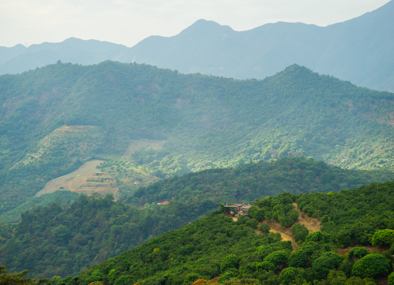
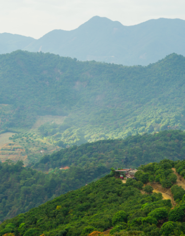
The Aravalli Range, one of the oldest mountain systems in the world, extends across northern India, spanning Delhi, Haryana, Rajasthan, and Gujarat. This ancient mountain range serves as a critical ecological barrier, providing a natural shield against desertification, air pollution, and water scarcity. The Aravallis have supported biodiversity for centuries and are integral to the region’s environmental stability. They regulate the local climate, assist in groundwater recharge, and protect the ecosystem from severe weather events. Despite their ecological significance, the Aravalli hills are under severe threat due to unregulated mining, urbanization, deforestation, and illegal activities that have damaged the landscape irreparably. The recent intervention by the Supreme Court of India in defining the Aravalli Range and banning new mining leases in the area brings the issue into sharp focus. This article provides a detailed analysis of the recent Aravalli crisis, the socio-economic and environmental consequences of the risks, and proposes effective risk management strategies for cities to protect and regenerate habitats and nature.
Background and Context of the Aravalli Crisis
The Supreme Court’s recent ruling regarding the definition of the Aravalli Range marks a pivotal moment in the region’s ecological management. The ruling provides a uniform definition, classifying an “Aravalli Hill” as any landform with an elevation of 100 meters or more above local relief. Similarly, an “Aravalli Range” is now defined as a collection of two or more such hills situated within 500 meters of each other. This definition aims to address the inconsistent understanding and categorization of the Aravallis across states, which had allowed mining activities to flourish even in ecologically sensitive zones.
While the court’s ruling seeks to protect the region from further encroachment, it has sparked a debate about the implications for mining, construction, and commercial activities. The Aravallis are rich in mineral resources, including tin, graphite, molybdenum, niobium, nickel, lithium, and rare earth elements (REEs). These resources are of growing strategic importance due to their role in the global energy transition and high-tech manufacturing sectors. However, unchecked mining in these regions can lead to severe ecological damage, including habitat destruction, soil erosion, and groundwater depletion.
The revised legal framework aims to curb unregulated activities by limiting mining leases. However, this also raises concerns about how to balance the economic potential of the Aravallis with the urgent need for ecological preservation. Hence, while the legal definition marks a significant step forward, it also calls for a deeper, more comprehensive risk management approach that integrates ecological sustainability and socio-economic development.
Ecological Risks Posed by Mining in the Aravalli Range
Mining and urbanization have been identified as the two primary factors contributing to the degradation of the Aravalli Range. The lack of effective regulations and enforcement mechanisms has allowed both legal and illegal mining operations to strip the landscape of its natural resources. Additionally, rapid urbanization in the National Capital Region (NCR) and surrounding areas has intensified the pressures on the environment. This section explores the specific ecological risks posed by mining and urbanization in the Aravalli region.
1. Soil Erosion and Desertification risks
Mining activities, particularly illegal stone and sand mining, have drastically altered the natural landscape of the Aravallis. By stripping away the soil and vegetation, mining accelerates erosion and disrupts the region’s ability to retain moisture. The removal of key plant species, which act as soil stabilizers, has exacerbated desertification, making the region more susceptible to arid conditions and extreme weather events.
The degradation of the Aravallis poses mining risks which have far-reaching consequences for agriculture in the surrounding regions. As soil fertility declines and groundwater levels drop, agricultural productivity suffers, particularly in areas that rely heavily on groundwater for irrigation. Moreover, desertification poses a direct threat to the livelihoods of local farmers and indigenous communities, many of whom depend on the land for their sustenance and income.
2. Biodiversity Loss
The Aravalli Range is home to a rich array of flora and fauna, including numerous species of birds, mammals, reptiles, and insects. Mining activities, especially those that involve blasting, pollute the air with dust and noise, forcing wildlife to flee their habitats. This fragmentation of natural habitats has resulted in the decline of species that depend on the Aravallis for food and shelter.
For example, species like the Indian leopard, striped hyena, golden jackal, and nilgai rely on the dense forests and rocky terrain of the Aravallis for protection. The disruption of these habitats leads to a reduction in wildlife populations, with some species facing local extinction due to the loss of microhabitats. Additionally, the region’s avian population, including species like vultures, peafowl, and migratory raptors, is under threat as their nesting grounds are destroyed by mining and deforestation.
3. Groundwater Depletion
One of the most alarming consequences of the degradation of the Aravalli Range is the reduction in groundwater recharge. The Aravallis serve as a vital source of groundwater for large parts of northern India, including the National Capital Region. Mining operations disturb the natural aquifers by breaking open the rock layers and blocking recharge channels. This disruption leads to a sharp decline in groundwater levels, which exacerbates water scarcity in urban and rural areas alike.
In regions like Gurugram, Faridabad, and Jaipur, where groundwater extraction exceeds replenishment by more than 300 percent, the situation is dire. As the water table continues to decline, the agricultural and industrial sectors in these areas face severe shortages. The over-extraction of water further strains the already limited resources, leading to millions of people facing water risk.
4. Climate Change and Extreme Weather Events
The degradation of the Aravallis also exacerbates the effects of climate change. The range acts as a natural buffer against dust storms, hot winds, and other extreme weather events. The removal of forests and vegetation weakens this natural barrier, allowing the desertification process to spread into the fertile plains of Rajasthan, Haryana, and Uttar Pradesh. Research has shown that when lower ridges of the Aravallis are removed, dust loads in the region increase significantly, leading to poor air quality and rising temperatures.
As urban heat islands intensify, the loss of green spaces in the Aravallis will further exacerbate surface temperatures, particularly in cities like Delhi and Gurugram, which are already among the most polluted cities in the world. These rising temperatures will contribute to climate risks such as more intense heatwaves, water scarcity, and erratic rainfall patterns, putting both human health and regional ecosystems at risk.
Socio-Economic Impact of the Aravalli Degradation
1. Impact on Tribal and Forest-Dependent Communities
Indigenous groups including the Meena, Bhil and Garasia communities in Rajasthan, along with forest-reliant villages in southern Haryana, depend on the Aravallis for fuelwood, fodder, minor forest produce and grazing.
2. Displacement of Small-Scale Enterprises
Thousands of households rely on forest-based livelihoods such as seasonal agriculture, pastoralism, honey harvesting, leaf plate production, collection of medicinal herbs and eco-tourism.
3. Impact on Urban Areas
Degraded hills intensify heat, dust storms and water shortages, disproportionately impacting low-income settlements around Delhi-NCR, Gurugram and Faridabad.
Risk Management Strategies for Protecting and Restoring the Aravalli Region’s Ecological Balance
- Establishing a uniform, ecologically grounded definition of the Aravallis to ensure consistency across legal, planning and administrative systems.
- Moving beyond elevation-based definitions to include recharge potential, slope stability, vegetation continuity, wildlife corridor connectivity and landscape integrity as core criteria for protection and planning.
- Using digital elevation models, remote sensing and GIS-based terrain mapping to clearly identify Aravalli features and remove ambiguity in regulatory and legal frameworks. Mapping should inform zoning, protection status and enforcement mechanisms.
- Aligning land-use decisions, mining, urban expansion and infrastructure development with the ecological limits of the Aravalli landscape to prevent irreversible degradation.
- Maintaining ridge continuity to prevent sharp increases in dust loads, which research shows can rise four to six times when lower ridges are breached. Treating the Aravallis as essential natural infrastructure for air quality management and heat mitigation in Delhi-NCR.
- Recognising the Aravallis as a critical fractured-rock aquifer recharge system. Preventing dilution of legal protection for recharge zones to avoid accelerating groundwater depletion, which already exceeds replenishment rates by over 300%, threatening agriculture, and domestic and industrial water supply.
- Restoring ponds and wetlands to enhance groundwater recharge and water security. Implementing phytoremediation to rehabilitate contaminated and mined lands.
- Undertaking catchment treatment and watershed development on forest, community and agricultural lands. Promoting traditional water-harvesting systems such as johads, chaukas and khadeens, alongside climate-resilient agriculture, soil moisture conservation and invasive species management to recharge aquifers and reduce water stress.
- Restoring degraded scrublands and grasslands, which constitute a significant share of degraded land, by introducing native and multipurpose species, improving grazing practices, conserving soil moisture and increasing carbon sequestration.
- Introducing structured grassland management to improve fodder availability. Promoting controlled grazing, stall feeding and ration balancing to reduce pressure on forests, enhance livestock health and productivity, and improve community incomes.
- Supporting eco-tourism and rural tourism in restored areas to reduce economic risk and generate sustainable livelihoods while conserving cultural and ecological diversity. Encouraging agroforestry, silvi-pastoral systems and sustainable harvesting of forest produce.
- Explicitly incorporating Aravalli landscapes into climate models and risk assessments for droughts, floods, heatwaves and dust storms. Accurate representation of runoff regulation, infiltration, and slope stability is essential, particularly as Delhi-NCR and the Indo-Gangetic plains face intensified climate extremes.
- Placing community participation, especially of women, at the centre of restoration efforts through Joint Forest Management Committees, Self-Help Groups, dairy cooperatives and Panchayati Raj Institutions.
- Conducting large-scale training for government staff and local stakeholders on restoration techniques, native species selection, agroforestry, water budgeting, soil conservation, grazing management and biodiversity documentation.
- Enhancing monitoring systems, imposing stricter penalties for violations, regulating stone-crushing units, and ensuring transparency and accountability in mining operations. No new mining leases or renewals should be granted until comprehensive mapping and ecological assessments are completed.
- Integrating advanced remote sensing, GIS and time-series analysis for planning, monitoring Aravalli landscape restoration progress, assessing carbon stocks, tracking land degradation and enabling transparent performance reviews.
- Promoting strict zoning laws, transparent environmental impact assessments and collaborative decision-making involving communities. Strengthening coordination between the judiciary and executive to ensure conservation policies are guided by empirical scientific evidence.
Biodiversity loss and actions to regenerate habitats and nature at a city-level globally
A 2024 report by the World Wide Fund for Nature (WWF) revealed a 73% decline in the average size of global wildlife populations over the past five decades, identifying habitat loss and degradation as the primary drivers of this collapse. This biodiversity crisis is unfolding alongside rapid global urbanization, placing cities at the centre of both the problem and the solution.
As urban areas expand, cities face the challenge of accommodating growing populations while creating space for nature and wildlife to survive and recover. Embracing a city’s natural identity and balancing urban development with environmental stewardship is increasingly seen as essential to building a sustainable future.
Across the world, nature-based solutions are shaping urban transformation. Biodiversity protection, circular economy principles, renewable energy deployment and climate resilience are emerging as the strategic foundations of nature-positive urban development, demonstrating that economic growth and ecological health need not be mutually exclusive.
Many cities are investing in programmes focused on urban greening, restoration of water bodies and expansion of renewable energy infrastructure. Initiatives such as biogas plants, solar-powered public lighting systems and the formal integration of informal recyclers into waste management systems along with urban planning approaches that create green corridors, protect coastlines and conserve sensitive ecosystems highlight how nature-aligned infrastructure can enhance environmental sustainability rather than compromise it.
In flood-prone cities, regulating urban development along riverbanks and watershed lands has become critical. Integrated interventions that combine infrastructure provision, housing replacement and environmental restoration help reduce flood risks while regenerating degraded ecosystems.
One of the greatest threats to biodiversity remains rapid—and often informal—urban development. Housing shortages frequently push informal settlements into ecologically sensitive areas, leading to habitat loss and degradation. City authorities are increasingly encouraged to prioritize coordinated, cross-agency solutions that balance housing needs with environmental regeneration. Community gardens in densely populated neighbourhoods and the integration of biodiversity education into school curricula are among the recommended measures.
Industrialization poses additional challenges, including fine dust pollution, flood risks and water management difficulties. To address these pressures, some cities are developing Natural Environment Conservation Action Plans aimed at expanding protected areas, strengthening wildlife protection and improving ecosystem management through robust governance, public–private participation and nature education programmes.
Partnerships with federal governments, international agencies, the private sector and local communities are central to the success of urban biodiversity initiatives. Building strong public–private–community collaborations enables cities to mobilize resources, expertise and innovation at scale.
Ultimately, living alongside nature in cities means recognising that urban development and biodiversity protection are closely linked. With innovative thinking, collective effort and a strong focus on nature-positive choices, cities can help build a global approach to urban development risks that integrates nature and enables both communities and ecosystems to flourish.
Best practices for eco-restoration and replicable models for sustainable urban development
India
- Land restoration programmes in Andhra Pradesh, Odisha and Madhya Pradesh demonstrate the effectiveness of community-led forest regeneration. In these regions, severe degradation caused by overextraction, invasive species, soil erosion and frequent fires was addressed through village-level committees that regulated grazing, uncontrolled fires and resource use. Implemented by the Foundation for Ecological Security across more than one million hectares, the initiative combined removal of invasive species, soil treatment, native species plantation and local nurseries, resulting in high sapling survival rates and improvements in groundwater levels, biodiversity and rural livelihoods.
- The rehabilitation of degraded hills in Rajasthan provides a strong model for combining afforestation with rainwater harvesting. In Banswara district, the Arid Forest Research Institute implemented contour trenches, ditches and mixed native plantations across degraded slopes. These interventions enhanced soil moisture, reduced runoff and significantly improved seedling survival and growth, demonstrating how landscape-level water management can support long-term ecological recovery.
- Best practices for preventing wind erosion in hot arid regions have also been documented by the Arid Forest Research Institute in western Rajasthan. The use of surface vegetation to stabilize sand dunes has helped control land degradation, improve soil fertility and address fodder and fuelwood shortages. This approach shows how restoring vegetative cover can reduce soil and water erosion while supporting local livelihoods in desert areas.
Around the world
- The Africa Sustainable Commodities Initiative illustrates how sustainable production and forest conservation can be integrated. Across ten African countries, the initiative promotes responsible production of commodities such as palm oil, rubber and shea while advancing forest restoration in production landscapes. Policy reforms, new institutions and strengthened governance have enabled public–private collaboration that balances economic development with environmental protection.
- In Edo State, Nigeria, forest governance reforms now require palm oil investors to protect forest areas, support smallholders and restore 10–25 percent of their concession land, directly linking investment to ecological restoration.
- In Liberia, participatory land-use planning supported by government agencies has empowered Indigenous people and local communities to define land-use priorities. Communities are allocating land for conservation and receiving payments to protect standing forests, reinforcing local ownership, rights and ecological resilience.
- In Ghana, the Asunafo–Asutifi landscape programme highlights the value of collective action. Communities, government and cocoa companies are collaborating to restore and conserve forests under the national REDD+programme, with funding being channeled directly to local communities to strengthen forest restoration and management efforts, thereby embedding climate risk mitigation objectives within forest conservation initiatives.
Together, these case studies show that eco-restoration and sustainable development succeed when global strategies are translated into local, community-driven solutions. Empowering people with decision-making authority and aligning economic incentives with ecological outcomes are central to building resilient landscapes and sustainable futures.
Conclusion
The decline of biodiversity is often framed as a far-removed concern. In reality, this crisis is immediate and unfolding now. What is more, the erosion of nature intensifies challenges we already view as urgent, including climate change.
The degradation of nature is closely connected to shortages of raw materials, fractured supply chains, water crisis, food instability and even the weakening of insurance systems. Almost half of the world’s economic output depends significantly on nature and the benefits it provides. In reality, however, the entire global economy depends on nature for its very existence.
For decision-makers, the debate has shifted from whether action is necessary to how rapidly nature considerations can be integrated into corporate strategy, reporting frameworks and investment choices. This directly relates to business decisions around resilience, risk management, growth opportunities and enduring value.
Decisive action on nature and biodiversity will shape whether institutions simply survive or truly prosper in a world where sustainability is no longer negotiable. The future hinges on a new paradigm—one in which economic progress and ecological health reinforce each other.
FAQS
1.What is the ecological importance of the Aravalli Range?
The Aravalli Range, one of the oldest mountain systems in the world, extends across northern India, spanning Delhi, Haryana, Rajasthan, and Gujarat. This ancient mountain range serves as a critical ecological barrier, providing a natural shield against desertification, air pollution, and water scarcity. The Aravallis have supported biodiversity for centuries and are integral to the region’s environmental stability. They regulate the local climate, assist in groundwater recharge, and protect the ecosystem from severe weather events.
2. How can risk management help in restoring the Aravalli Range?
The following Risk Management strategies can be implemented for protecting and restoring the Aravalli region’s ecological balance –
- Restoring ponds and wetlands to enhance groundwater recharge and water security. Implementing phytoremediation to rehabilitate contaminated and mined lands.
- Undertaking catchment treatment and watershed development on forest, community and agricultural lands. Promoting traditional water-harvesting systems alongside climate-resilient agriculture, soil moisture conservation and invasive species management to recharge aquifers and reduce water stress.
- Explicitly incorporating Aravalli landscapes into climate models and risk assessments for droughts, floods, heatwaves and dust storms.
- Conducting large-scale training for government staff and local stakeholders on restoration techniques, native species selection, agroforestry, water budgeting, soil conservation, grazing management and biodiversity documentation.
- Integrating advanced remote sensing, GIS and time-series analysis for planning, monitoring restoration progress, assessing carbon stocks, tracking land degradation and enabling transparent performance reviews.
3. What role does the Institute of Risk Management (IRM) play in environmental risk management education?
In India—where rapid economic development intersects with pressing environmental and social challenges—ESG has gained significant traction. India faces severe climate-related challenges: erratic monsoons, rising temperatures, and frequent extreme weather events that disrupt agriculture, infrastructure, and overall economic stability which is a huge environmental risk in itself. Businesses and supply chains are directly affected by these disruptions, intensifying the need for risk analysis and mitigation strategies.
In response to these developments, ESG Risk Managers have emerged as key players within organizations across various industries, from large conglomerates and multinational corporations to fast-growing startups.
The Institute of Risk Management (IRM) is recognized globally as the leading professional body for Enterprise Risk Management, and it is the only organization to offer formal designations culminating in a Fellowship in ERM at Level 5. Covering risk identification, assessment, mitigation, and reporting across 300 areas of risk, IRM’s multi-level qualifications equip professionals with the holistic perspective required to manage ESG-related threats effectively. In India, candidates can pursue IRM’s Global Enterprise Risk Management exams through the IRM India Affiliate, which offers localized support and resources. Progressing through each of IRM’s five levels ensures that risk professionals can apply a comprehensive, enterprise-wide lens to ESG challenges—whether they involve environmental compliance, labor standards, or robust corporate governance. Achieving these globally recognized certifications not only enhances career prospects but also positions professionals to integrate risk management best practices into an organization’s sustainability strategy.